More Info
KPOP Image Download
  • Top University
  • Top Anime
  • Home Design
  • Top Legend


  1. ENSIKLOPEDIA
  2. Berkas:Austro-Hungarian Monarchy (1914).svg - Wikipedia bahasa Indonesia, ensiklopedia bebas
Berkas:Austro-Hungarian Monarchy (1914).svg - Wikipedia bahasa Indonesia, ensiklopedia bebas

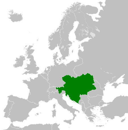
Berkas:Austro-Hungarian Monarchy (1914).svg
Konten halaman tidak didukung dalam bahasa lain.
  • Berkas
  • Pembicaraan
  • Baca
  • Lihat di Wikimedia Commons
Perkakas
Tindakan
  • Baca
  • Lihat di Wikimedia Commons
Umum
  • Pranala balik
  • Versi cetak
  • Informasi halaman
  • Lihat URL pendek
  • Unduh kode QR
Dalam proyek lain
Tampilan
Dari Wikipedia bahasa Indonesia, ensiklopedia bebas
  • Berkas
  • Riwayat berkas
  • Penggunaan berkas
  • Penggunaan berkas global
  • Metadata
Berkas:Austro-Hungarian Monarchy (1914).svg
Ukuran pratayang PNG ini dari berkas SVG ini: 450 × 456 piksel Resolusi lainnya: 237 × 240 piksel | 474 × 480 piksel | 758 × 768 piksel | 1.011 × 1.024 piksel | 2.021 × 2.048 piksel.

Ukuran asli (Berkas SVG, secara nominal 450 × 456 piksel, besar berkas: 456 KB)

Berkas ini berasal dari Wikimedia Commons dan mungkin digunakan oleh proyek-proyek lain. Deskripsi dari halaman deskripsinya ditunjukkan di bawah ini.

Ringkasan

DeskripsiAustro-Hungarian Monarchy (1914).svg
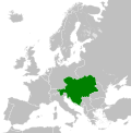
English: The Austro-Hungarian Monarchy in 1914.
Tanggal 8 Maret 2012
Sumber Karya sendiri
 
This vector image includes elements that have been taken or adapted from this file:
 German Empire 1914.svg (oleh Alphathon).
Pembuat TRAJAN 117
Izin
(Menggunakan kembali berkas ini)
Saya, pemilik hak cipta dari karya ini, dengan ini menerbitkan berkas ini di bawah ketentuan berikut:
GNU head Diizinkan untuk menyalin, mendistribusikan dan/atau memodifikasi dokumen ini di bawah syarat-syarat Lisensi Dokumentasi Bebas GNU, Versi 1.2 atau lebih baru yang diterbitkan oleh Free Software Foundation; tanpa Bagian Invarian, tanpa Teks Sampul Depan, dan tanpa Teks Sampul Belakang. Salinan lisensi dimasukkan ke bagian yang berjudul Lisensi Dokumentasi Bebas GNU.http://www.gnu.org/copyleft/fdl.htmlGFDLGNU Free Documentation Licensetruetrue
w:id:Creative Commons
atribusi berbagi serupa
Berkas ini dilisensikan dengan lisensi Creative Commons Atribusi-BerbagiSerupa 3.0 Tanpa Adaptasi, 2.5 Generik, 2.0 Generik, dan 1.0 Generik.
Anda diizinkan:
  • untuk berbagi – untuk menyalin, mendistribusikan dan memindahkan karya ini
  • untuk menggubah – untuk mengadaptasi karya ini
Berdasarkan ketentuan berikut:
  • atribusi – Anda harus mencantumkan atribusi yang sesuai, memberikan pranala ke lisensi, dan memberi tahu bila ada perubahan. Anda dapat melakukannya melalui cara yang Anda inginkan, namun tidak menyatakan bahwa pemberi lisensi mendukung Anda atau penggunaan Anda.
  • berbagi serupa – Apabila Anda menggubah, mengubah, atau membuat turunan dari materi ini, Anda harus menyebarluaskan kontribusi Anda di bawah lisensi yang sama atau kompatibel dengan lisensi pada materi asli.
https://creativecommons.org/licenses/by-sa/3.0CC BY-SA 3.0 Creative Commons Attribution-Share Alike 3.0 truetrue
Anda dapat memilih lisensi pilihan Anda.
Versi lainnya
English: This map is part of a series of historical political maps of Europe. All maps by Alphathon and based upon Blank map of Europe.svg unless otherwise stated.
Deutsch: Diese Karte ist Teil einer Serie historischer politischer Europakarten. Solange nicht anders angegeben, wurden alle Karten durch Alphathon auf Basis von Blank map of Europe.svg erstellt, sofern nicht anders angegeben.
Français : Cette carte fait partie d'une série de cartes historiques et politiques d'Europe. Toutes les cartes ont été créées par Alphathon et basées sur Blank map of Europe.svg sauf indication contraire.
Evolution of specific states

Greece/Byzantine Empire
Byzantine Empire: ca. 330 – 1204; 1261 – 1453
Byzantine Empire – 814 Byzantine Empire – 1190
1453 – 1832
Between 1453 and 1832 there was no independent Greek state. During this period the region was ruled by the Byzantine Empire's Turkish successor: the Ottoman Empire.
Greece: 1832 – Today
Kingdom of Greece – 1890 Kingdom of Greece – 1914 Second Hellenic Republic – 1935 Hellenic State – 1942 Kingdom of Greece – 1973
France
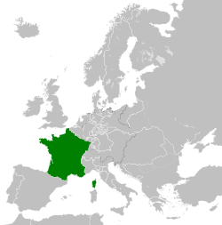
Frankish Empire – 814 West Francia – 843 Kingdom of France – 1000 Kingdom of France – 1097 Kingdom of France – 1190
Kingdom of France – 1789 First French Empire – 1812 Kingdom of France – 1815 Kingdom of France – 1839 French Third Republic – 1914
French Third Republic – 1939 French State (Vichy France) – 1942 Provisional Government of the French Republic – 1945-1949 French Fourth Republic – 1946-1957
See also: French State (incl. occupation zone) – 1942, Military Administration in France – 1942, Military Administration in Belgium and Northern France – 1942
Germany/Holy Roman Empire
Frankish Empire – 814 East Francia – 843 Holy Roman Empire – 1000 Holy Roman Empire – 1004 Holy Roman Empire – 1097 Holy Roman Empire – 1190 Holy Roman Empire – 1789
See also: Kingdom of Germany – 1000 See also: Kingdom of Germany – 1004
1806
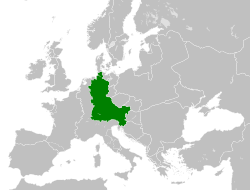
Confederation of the Rhine – 1812 German Confederation – 1815 North German Confederation – 1870
A confederation of German client-states of the First French Empire An attempted partial resurrection of the Holy Roman Empire after the Napoleonic wars A Prussian-dominated successor to the German Confederation following the 1866 Austro-Prussian War
1871
German Empire – 1914 Weimar Republic – 1930 German Reich – November 1938-March 1939 German Reich – Mar-Sep 1939 Greater German Reich – 1942 Federal Republic of Germany (West Germany) – 1956-90 German Democratic Republic (East Germany) – 1956-90
Austria
Habsburg Monarchy – 1714 Habsburg Monarchy – 1789 Austrian Empire – 1812 Austrian Empire – 1815 Austria-Hungary – 1914 Federal State of Austria – 1938
See also: Austrian Empire excluding Lombardy-Venetia – 1815, Kingdom of Lombardy-Venetia – 1815
Hungary
Approx. territory of the Mayars in 814 Kingdom of Hungary – 1000 Kingdom of Hungary – 1097 Kingdom of Hungary – 1190 Habsburg Monarchy – 1714 Habsburg Monarchy – 1789
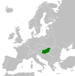
Austrian Empire – 1812 Austrian Empire – 1815 Austria-Hungary – 1914 Kingdom of Hungary – 1929-1938 Kingdom of Hungary – 1942 Second Hungarian Republic – 1945-1949
See also: Austrian Empire excluding Lombardy-Venetia – 1815, Kingdom of Lombardy-Venetia – 1815
Hungarian People's Republic – 1956-1990
Italy
Northern Italy
774 – ≈1176 /1805
Frankish Empire – 814 Middle Francia – 843 Kingdom of Italy (Holy Roman Empire) – 1000
1805 – 1814
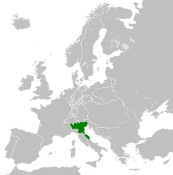
Kingdom of Italy (Napoleonic) – 1812
Southern Italy
774 – 1860
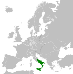
Norman possessions in southern Italy – 1097 Norman Kingdom of Sicily – 1190 Kingdom of the Two Sicilies – 1839
Risorgimento
1860 – 20xx
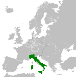
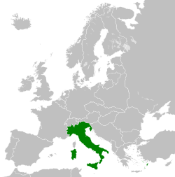
Kingdom of Sardinia – 1860 Kingdom of Italy – 1861 Kingdom of Italy – 1870 Kingdom of Italy – 1914 Kingdom of Italy – 1936 Kingdom of Italy – 1943 Italian Social Republic – 1943
Poland
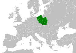
Duchy of Poland – 1000 Kingdom of Poland – 1097 Kingdom of Poland – 1190 Polish-Lithuanian Commonwealth – 1714 Polish-Lithuanian Commonwealth – 1789
Duchy of Warsaw – 1812 Congress Poland – 1815 Second Polish Republic – 1930 General Government – 1942 Polish People's Republic – 1956-90
See also: Free City of Danzig – 1812 See also: Free City of Danzig – 1930
Brandenburg, the Teutonic Order and Prussia
Kingdom of Prussia – 1714 Kingdom of Prussia – 1789 Kingdom of Prussia – 1797 Kingdom of Prussia – 1812 Kingdom of Prussia – 1815 Kingdom of Prussia – 1870
9th Century

814
Blank map of Europe 814.svg
  • Francia/Frankish Empire/Carolingian Empire
  • Byzantine (East Roman) Empire
  • First Bulgarian Empire
  • Kingdom of Asturias
  • Approx. territory of the Magyars
843
Blank map of Europe 843.svg
  • West Francia
  • Middle Francia
  • East Francia
11th Century

1000
Blank map of Europe 1000.svg
  • Holy Roman Empire
    • Kingdom of Germany
    • Kingdom of Italy
  • Kingdom of Arles/Arelat/Burgundy
  • Kingdom of France
  • Kingdom of Hungary
  • Duchy of Poland
  • Duchy of Bohemia
1004
Blank map of Europe 1004.svg
  • Holy Roman Empire
    • Kingdom of Germany
1097
Blank map of Europe 1097.svg
  • Holy Roman Empire
  • Kingdom of France
  • Kingdom of Hungary
  • Kingdoms of Castile and León
  • Norman possessions in Southern Italy
12th Century

1190
Blank map of Europe 1190.svg
  • Holy Roman Empire
  • Byzantine (East Roman) Empire
  • Angevin Empire (England)
  • Kingdom of France
  • Kingdom of Hungary
  • Kingdom of Poland
  • (Norman) Kingdom of Sicily
  • Kingdom of Aragon
  • Kingdoms of Castile and León
  • Kingdom of Portugal
18th Century

1714
Blank map of Europe 1714.svg
  • Kingdom of Prussia
  • Habsburg Monarchy
  • Polish-Lithuanian Commonwealth
  • Swiss Confederacy
1789
Europe 1789.svg
  • Holy Roman Empire
    •  (Alternative version excluding extra-imperial Prussian and Habsburg territory derivative work by TRAJAN 117) 
  • Habsburg Monarchy
    •  (alternative file: Habsburg Hereditary Lands derivative work by TRAJAN 117) 
    • Austrian Netherlands
    • Duchy of Milan
  • Kingdom of Prussia
  • Electorate of Brunswick-Lüneburg
  • Electorate of Bavaria
  • Electorate of Saxony
  • Duchy of Württemberg
  • Duchy of Mecklenburg-Schwerin
  • Duchy of Holstein
  • Landgraviate of Hesse-Kassel
  • Ecclesiastical lands of the Holy Roman Empire
  • Republic of Venice
  •  Duchy of Parma and Piacenza derivative work by Facquis 
  • Papal States
  • Grand Duchy of Tuscany
  • Kingdom of Sardinia
  • Republic of Genoa
  • Polish-Lithuanian Commonwealth
  • Kingdom of Sweden
  • Kingdom of Great Britain
  •  Kingdom of Ireland derivative work by Elevatorrailfan 
  •  Kingdom of France derivative work by TRAJAN 117 
    •  (Cropped version derivative work by Dbachmann) 
  •  Dutch Republic derivative work by TRAJAN 117 
  •  Kingdom of Spain derivative work by TRAJAN 117 
  •  Voivodeship of Wallachia derivative work by TRAJAN 117 
  •  Voivodeship of Moldavia derivative work by TRAJAN 117 
1797
Europe 1797.svg derivative work by Facquis
  • Batavian Republic
  • Cisalpine Republic
  • Kingdom of Prussia
19th Century

1812
Europe at the height of Napoleon's power.
Blank map of Europe 1812.svg
  • First French Empire and its satellite states
  •  French Empire derivative work by TRAJAN 117 
  •  Confederation of the Rhine derivative work by TRAJAN 117 
  •  Austrian Empire derivative work by TRAJAN 117 
  • Kingdom of Bavaria
  • Kingdom of Westphalia
  • Kingdom of Saxony
  •  Principality of Erfurt derivative work by OwenBlacker 
  •  Free City of Danzig derivative work by TRAJAN 117 
  •  Duchy of Warsaw derivative work by TRAJAN 117 
  •  Prince-Bishopric of Montenegro derivative work by TRAJAN 117 
  •  Territory of the First Serbian Uprising derivative work by TRAJAN 117 
  •  Voivodeship of Wallachia derivative work by TRAJAN 117 
  •  Voivodeship of Moldavia derivative work by TRAJAN 117 
  •  Kingdom of Italy derivative work by TRAJAN 117 
  •  Kingdom of Spain derivative work by TRAJAN 117 
1815
Europe following the Congress of Vienna, which restored much of the old order following the Napoleonic wars.
Blank map of Europe 1815.svg
  • German Confederation
  •  German Confederation (alt. colour scheme) derivative work by TRAJAN 117 
  • Austrian Empire
  •  Austrian Empire (incl. Lombardy-Venetia) derivative work by TRAJAN 117 
  • Kingdom of Lombardy-Venetia
  • Kingdom of Prussia
  • Kingdom of Bavaria
  • Kingdom of Hanover
  • Kingdom of Württemberg
  • Kingdom of Saxony
  • Grand Duchy of Baden
  • United Kingdom of the Netherlands
  • Grand Duchy of Luxembourg
  • Kingdom of Sardinia
  • Free, Independent, and Strictly Neutral City of Kraków
  • Congress Poland
  •  Kingdom of France derivative work by TRAJAN 117 
1839
Blank map of Europe 1839.svg
derivative work by ArnoldPlaton
  •  Kingdom of France derivative work by Elevatorrailfan 
  •  Kingdom of the Two Sicilies derivative work by Elevatorrailfan 
1860
Blank map of Europe 1860.svg
  • Kingdom of Sardinia
1861
Blank map of Europe 1861.svg
  • Kingdom of Italy
1870
Blank map of Europe 1870.svg
  • North German Confederation
    • Kingdom of Prussia
  • Kingdom of Italy
1890
Blank map of Europe 1890.svg
  •  Principality of Bulgaria derivative work by TRAJAN 117 
  •  Kingdom of Greece derivative work by TRAJAN 117 
  •  Principality of Montenegro derivative work by TRAJAN 117 
  •  Kingdom of Portugal derivative work by TRAJAN 117 
  •  Kingdom of Romania derivative work by TRAJAN 117 
20th Century

1914
Blank map of Europe 1914.svg
  • German Empire
    • Province of Pomerania
  •  Austria-Hungary derivative work by TRAJAN 117 
  •  French Third Republic derivative work by Sémhur 
  •  Grand Duchy/Principality of Finland derivative work by TRAJAN 117 
  •  Kingdom of Italy derivative work by WindEwriX 
  •  Kingdom of Bulgaria derivative work by TRAJAN 117 
  •  Kingdom of Greece derivative work by TRAJAN 117 
  •  Kingdom of Serbia derivative work by TRAJAN 117 
  •  Kingdom of Montenegro derivative work by TRAJAN 117 
  •  Kingdom of Romania derivative work by TRAJAN 117 
1929-1938
Blank map of Europe 1929-1938.svg
  • The Weimar Republic
  •  Czechoslovakia/Czechoslovak Republic derivative work by TRAJAN 117 
  • Free City of Danzig
  •  Albanian Kingdom derivative work by TRAJAN 117 
  • Second Polish Republic
  •  Second Hellenic Republic (Greece) derivative work by TRAJAN 117 
  •  Second Spanish Republic derivative work by TRAJAN 117 
  •  Kingdom of Yugoslavia derivative work by TRAJAN 117 
  •  Kingdom of Italy derivative work by TRAJAN 117 
  •  Spanish Morocco derivative work by TRAJAN 117 
  •  The Little Entente derivative work by Tschechoslowakei 
  •  Irish Free State derivative work by Elevatorrailfan 
  •  Federal State of Austria derivative work by TRAJAN 117 
  • Kingdom of Hungary
October 1938 - March 1939
Blank map of Europe October 1938 - March 1939.svg
  •  German Reich (Nazi Germany) derivative work by TRAJAN 117 
  •  (First) Czechoslovak Republic (Czechoslovakia) derivative work by TRAJAN 117 
  •  Kingdom of Romania derivative work by TRAJAN 117 
  •  Albanian Kingdom derivative work by TRAJAN 117 
March - September 1939
Blank map of Europe March - September 1939.svg
derivative work by Goran tek-en
  •  German Reich (Nazi Germany) derivative work by DIREKTOR 
  •  French Third Republic derivative work by DIREKTOR 
1942
Europe 1942.svg
  •  Europe in 1942 (coloured, with legend and labels) derivative work by Goran tek-en 
    •  Europe in 1942 (coloured, with key) derivative work by Goran tek-en 
    •  Europe in 1942 (coloured, no key) derivative work by Goran tek-en 
  •  Axis Occupation of Europe (1942) derivative work by TRAJAN 117 
  •  German Reich + occupations derivative work by DIREKTOR 
    •  11-19 November derivative work by DIREKTOR 
  •  Greater German Reich (Nazi Germany) derivative work by TRAJAN 117 
    •  (Alternative file derivative work by DIREKTOR) 
    •  General Government (Poland) derivative work by TRAJAN 117 
    •  Protectorate of Bohemia and Moravia derivative work by TRAJAN 117 
  •  French State (incl. occupation zone) derivative work by TRAJAN 117 
    •  French State (excl. occupation zone) derivative work by DIREKTOR 
    •  Militärverwaltung in Frankreich derivative work by TRAJAN 117 
  •  Militärverwaltung in Belgien und Nordfrankreich derivative work by TRAJAN 117 
  •  Reichskommissariat Niederlande derivative work by TRAJAN 117 
  •  Reichskommissariat Norwegen derivative work by TRAJAN 117 
  •  Reichskommissariat Ostland derivative work by TRAJAN 117 
  •  Reichskommissariat Ukraine derivative work by TRAJAN 117 
    •  General District of Crimea derivative work by TRAJAN 117 
  •  Republic of Finland derivative work by TRAJAN 117 
  •  Kingdom of Hungary derivative work by TRAJAN 117 
  •  Kingdom of Romania derivative work by TRAJAN 117 
  •  Kingdom of Bulgaria derivative work by TRAJAN 117 
  •  Albanian Kingdom derivative work by TRAJAN 117 
  •  Kingdom of Iceland derivative work by TRAJAN 117 
  •  Hellenic State (Greece) derivative work by TRAJAN 117 
  • Territory of the Military Commander in Serbia (Occupied Serbia)
  •  Independent State of Croatia derivative work by TRAJAN 117 
  •  Slovak State/First Slovak Republic derivative work by TRAJAN 117 
  •  Italian Governorate (or Kingdom) of Montenegro derivative work by TRAJAN 117 
  •  Italian Social Republic derivative work by Elevatorrailfan 
    •  Italian Social Republic in 1943 derivative work by Elevatorrailfan 
  •  Ireland derivative work by Elevatorrailfan 
1956-1990
Blank map of Europe 1956-1990.svg
  •  People's Socialist Republic of Albania derivative work by StalwartUK 
  •  People's Republic of Bulgaria derivative work by StalwartUK 
  • Czechoslovakia
  •  East Germany/German Democratic Republic derivative work by StalwartUK 
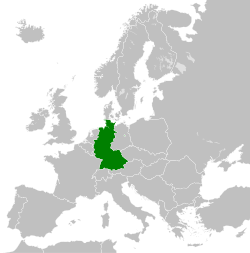
  •  West Germany/Federal Republic of Germany derivative work by StalwartUK 
  •  Kingdom of Greece derivative work by TRAJAN 117 
  •  People's Republic of Hungary derivative work by StalwartUK 
  •  Polish People's Republic derivative work by StalwartUK 
  •  People's/Socialist Republic of Romania derivative work by StalwartUK 
  •  Socialist Federal Republic of Yugoslavia derivative work by StalwartUK 
  •  Francoist Spain derivative work by TRAJAN 117 
  • NATO and the Warsaw Pact circa 1973
SVG genesis
InfoField
 
The source code of this SVG is invalid due to 4 errors.
 
W3C-tidak sah Gambar vektor ini dibuat menggunakan Inkscape

Captions

Add a one-line explanation of what this file represents
The Austro-Hungarian Monarchy in 1914.
Máte špatně vyznačenou hranici mezi Polskem A Německem
L'impero austro-ungarico nel 1914
L'Empire Austro-Hongrois en 1914
Osztrák-Magyar Monarchia 1914-ben
Monarchia Austro-Węgierska w 1914.
Dubbelmonarkin Österrike-Ungerns utbredning år 1914

Items portrayed in this file

menggambarkan

Austria-Hungaria

status hak cipta

berhak cipta

lisensi

Creative Commons Attribution-ShareAlike 2.0 Generic Inggris

Creative Commons Attribution-ShareAlike 1.0 Generic Inggris

Creative Commons Atribusi-BerbagiSerupa 3.0 Tanpa Adaptasi

Creative Commons Attribution-ShareAlike 2.5 Generic Inggris

Lisensi Dokumentasi Bebas GNU, versi 1.2 atau seterusnya

sejak

8 Maret 2012

sumber berkas

karya sendiri dari pengunggah

tipe media

image/svg+xml

checksum Inggris

c1ede94fd55b212ad20f67a6c5bb64fc20941ab6

metode penentuan: SHA-1

ukuran data

466.571 Bita

tinggi

456 piksel

lebar

450 piksel

Riwayat berkas

Klik pada tanggal/waktu untuk melihat berkas ini pada saat tersebut.

Tanggal/WaktuMiniaturDimensiPenggunaKomentar
terkini25 Juli 2013 17.34Miniatur versi sejak 25 Juli 2013 17.34450 × 456 (456 KB)AlphathonRemoved Dutch polders (weren't completed until the mid 20th century)
8 Maret 2012 12.39Miniatur versi sejak 8 Maret 2012 12.39450 × 456 (441 KB)TRAJAN 117{{Information |Description ={{en|1=The Austro-Hungarian Monarchy in 1914.}} |Source ={{own}} {{AttribSVG|German Empire 1914.svg|Alphathon}} |Author =25px '''TRAJAN 117'''...

Penggunaan berkas

Halaman berikut menggunakan berkas ini:

  • Austria-Hungaria

Penggunaan berkas global

Wiki lain berikut menggunakan berkas ini:

  • Penggunaan pada ab.wikipedia.org
    • Австриа-Венгриа
  • Penggunaan pada af.wikipedia.org
    • Oostenryk-Hongarye
  • Penggunaan pada af.wiktionary.org
    • Oostenryk-Hongarye
    • Aŭstrio-Hungario
  • Penggunaan pada als.wikipedia.org
    • Österreich-Ungarn
  • Penggunaan pada am.wikipedia.org
    • ኦስትሪያ-ሀንጋሪ
  • Penggunaan pada ang.wikipedia.org
    • Ēastrīce-Ungerland
  • Penggunaan pada an.wikipedia.org
    • Imperio Austrohongaro
  • Penggunaan pada ar.wikipedia.org
    • الإمبراطورية النمساوية المجرية
    • بوابة:الإمبراطورية النمساوية المجرية
    • بوابة:الإمبراطورية النمساوية المجرية/واجهة
  • Penggunaan pada azb.wikipedia.org
    • اوتریش-ماجاریستان
  • Penggunaan pada az.wikipedia.org
    • Avstriya-Macarıstan
  • Penggunaan pada bar.wikipedia.org
    • Östareich-Ungarn
  • Penggunaan pada ba.wikipedia.org
    • Иң ҙур дәүләттәр исемлеге
    • Австро-Венгрия
  • Penggunaan pada be-tarask.wikipedia.org
    • Аўстра-Вугоршчына
  • Penggunaan pada be.wikipedia.org
    • Аўстра-Венгрыя
  • Penggunaan pada bg.wikipedia.org
    • Австро-Унгария
  • Penggunaan pada bn.wikipedia.org
    • অস্ট্রিয়া-হাঙ্গেরি
  • Penggunaan pada bs.wikipedia.org
    • Austro-Ugarska
  • Penggunaan pada bxr.wikipedia.org
    • Австри-Унгар
  • Penggunaan pada ce.wikipedia.org
    • Австро-Мажаройчоь
  • Penggunaan pada crh.wikipedia.org
    • Avstriya-Macaristan
  • Penggunaan pada cs.wikipedia.org
    • Rakousko-Uhersko
    • Halič
    • Uhersko
    • Rakouské Slezsko
    • České království
    • Šablona:Infobox - zaniklý stát
    • Tyrolské hrabství
    • Šablona:Infobox - zaniklý stát/doc
    • Rakouské arcivévodství
    • Moravské markrabství
    • Království chorvatsko-slavonské
    • Gorice a Gradiška
    • Korunní země
    • Štýrské vévodství
    • Rakouské přímoří
    • Kraňské vévodství
    • Markrabství Istrie
    • Šablona:Korunní země Rakouska-Uherska
    • Sedmihradské velkoknížectví
    • Wikipedista:Suzukitaro/temp1
    • Dalmatské království
    • Salcburské vévodství
    • Bukovinské vévodství
    • Korutanské vévodství
    • Rakousko-uherská okupace Bosny a Hercegoviny
    • Haličsko-vladiměřské království

Lihat lebih banyak penggunaan global dari berkas ini.

Metadata

Berkas ini mengandung informasi tambahan yang mungkin ditambahkan oleh kamera digital atau pemindai yang digunakan untuk membuat atau mendigitalisasi berkas. Jika berkas ini telah mengalami modifikasi, rincian yang ada mungkin tidak secara penuh merefleksikan informasi dari gambar yang sudah dimodifikasi ini.

Judul singkatCountries of Europe
Judul gambarA blank Map of Europe. Every country has an id which is its ISO-3166-1-ALPHA2 code in lower case.
Members of the EU have a class="eu", countries in europe (which I found turkey to be but russia not) have a class="europe".
Certain countries are further subdivided the United Kingdom has gb-gbn for Great Britain and gb-nir for Northern Ireland. Russia is divided into ru-kgd for the Kaliningrad Oblast and ru-main for the Main body of Russia. There is the additional grouping #xb for the "British Islands" (the UK with its Crown Dependencies - Jersey, Guernsey and the Isle of Man)

Contributors.
Original Image: (http://commons.wikimedia.org/wiki/Image:Europe_countries.svg) Júlio Reis (http://commons.wikimedia.org/wiki/User:Tintazul).
Recolouring and tagging with country codes: Marian "maix" Sigler (http://commons.wikimedia.org/wiki/User:Maix)
Improved geographical features: http://commons.wikimedia.org/wiki/User:W!B:
Updated to reflect dissolution of Serbia & Montenegro: http://commons.wikimedia.org/wiki/User:Zirland
Updated to include British Crown Dependencies as seperate entities and regroup them as "British Islands", with some simplifications to the XML and CSS: James Hardy (http://commons.wikimedia.org/wiki/User:MrWeeble)

Released under CreativeCommons Attribution ShareAlike (http://creativecommons.org/licenses/by-sa/2.5/).
Lebar450
Tinggi456
Diperoleh dari "https://id.wikipedia.org/wiki/Berkas:Austro-Hungarian_Monarchy_(1914).svg"

Best Rank
More Recommended Articles