More Info
KPOP Image Download
  • Top University
  • Top Anime
  • Home Design
  • Top Legend


  1. ENSIKLOPEDIA
  2. Berkas:Peta Surakarta 1945.jpg - Wikipedia bahasa Indonesia, ensiklopedia bebas
Berkas:Peta Surakarta 1945.jpg - Wikipedia bahasa Indonesia, ensiklopedia bebas

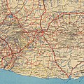
Berkas:Peta Surakarta 1945.jpg

Konten halaman tidak didukung dalam bahasa lain.
  • Berkas
  • Pembicaraan
  • Baca
  • Lihat di Wikimedia Commons
Perkakas
Tindakan
  • Baca
  • Lihat di Wikimedia Commons
Umum
  • Pranala balik
  • Versi cetak
  • Informasi halaman
  • Lihat URL pendek
  • Unduh kode QR
Dalam proyek lain
Tampilan
Dari Wikipedia bahasa Indonesia, ensiklopedia bebas
  • Berkas
  • Riwayat berkas
  • Penggunaan berkas
  • Penggunaan berkas global
Berkas:Peta Surakarta 1945.jpg
Ukuran pratayang ini: 494 × 600 piksel. Resolusi lainnya: 198 × 240 piksel | 395 × 480 piksel | 633 × 768 piksel | 844 × 1.024 piksel | 2.382 × 2.891 piksel.
Ukuran asli (2.382 × 2.891 piksel, ukuran berkas: 1,08 MB, tipe MIME: image/jpeg)

Berkas ini berasal dari Wikimedia Commons dan mungkin digunakan oleh proyek-proyek lain. Deskripsi dari halaman deskripsinya ditunjukkan di bawah ini.

Ringkasan

Java and Madura. Road map   (Wikidata search (Cirrus search) Wikidata query (SPARQL)  Create new Wikidata item based on this file)
Pembuat
Grande-Bretagne. War office. Auteur du texte
Judul
Java and Madura. Road map
Deskripsi
English: Map of Surakarta in 1945. Compare to present day map
Français : (Original description)

Sujet : Java, Île de -- Routes Échelle(s) : 1:500 000 Couverture : Indonésie Langue : anglais

Éditeur : War Office
Tanggal 1945
date QS:P571,+1945-00-00T00:00:00Z/9
Ukuran tinggi: 60 cm; lebar: 85 cm
dimensions QS:P2048,60U174728
dimensions QS:P2049,85U174728
Koleksi
Bibliothèque nationale de France   wikidata:Q193563
Bibliothèque nationale de France
Nama asli Bibliothèque nationale de France Sunting ini di Wikidata
Institusi induk Ministry of Culture of France Sunting ini di Wikidata
Lokasi
Arondisemen ke-2 Paris Sunting ini di Wikidata, Prancis
Koordinat 48° 50′ 01″ U, 2° 22′ 33″ T Link to OpenStreetMap Link to Google Maps Sunting ini di Wikidata
Didirikan 1368
Situs web www.bnf.fr/en Sunting ini di Wikidata
Pengawasan otoritas
  • wikidata:Q193563: Q193563
  • VIAF: 137156173
  • ISNI: 0000000123531945
  • ULAN: 500309981
  • LCCN: no95028191
  • GND: 5156217-0
  • WorldCat
institution QS:P195,Q193563
Referensi
Français : Notice du catalogue : http://catalogue.bnf.fr/ark:/12148/cb406945659
Sumber/Fotografer
Français : Bibliothèque nationale de France, département Cartes et plans, GE C-17336
Bibliothèque nationale de France
Izin
(Menggunakan kembali berkas ini)
Public domainPublic domainfalsefalse
Public domain
This work is in the public domain in France for one of the following reasons:
  • Its author (or the last of its authors in the case of a collaboration work) died more than 70 years ago (CPI art. L123-1) and did not benefit from any copyright extension (CPI art. L123-8, L123-9 and L123-10)[1];
  • It is an anonymous or pseudonymous work (the identity of the author has never been disclosed) or a collective work[2] and more than 70 years have passed since its publication (CPI art. L123-3);
  • It is the recording of an audiovisual or musical work already in the public domain, and more than 50 years have passed since the performance or the recording (CPI art. L211-4).

Please note that moral rights still apply when the work is in the public domain. They encompass, among others, the right to the respect of the author's name, quality and work (CPI art. L121-1). Attribution therefore remains mandatory.
  1. ↑ Copyright extensions must be considered only in the case of musical works and of authors Mort pour la France (died during conflict, in the service of France). In other cases, they are included in the 70 years post mortem auctoris length (see this statement of the Cour de Cassation).
  2. ↑ The collective work status is quite restrictive, please make sure that it is actually established.

العربية ∙ English ∙ español ∙ français ∙ 日本語 ∙ 한국어 ∙ македонски ∙ русский ∙ Tiếng Việt ∙ 简体中文 ∙ 繁體中文 ∙ +/−

Versi lainnya
image extraction process
Berkas ini berasal dari berkas lain
: Java and Madura. Road map - btv1b531894748.jpg
berkas asli

Captions

Add a one-line explanation of what this file represents

Items portrayed in this file

menggambarkan

ukuran data

1.131.302 Bita

tinggi

2.891 piksel

lebar

2.382 piksel

tipe media

image/jpeg

checksum Inggris

097f632cfeac20c8607d696283c74aabd66fbc7a

metode penentuan: SHA-1

Riwayat berkas

Klik pada tanggal/waktu untuk melihat berkas ini pada saat tersebut.

Tanggal/WaktuMiniaturDimensiPenggunaKomentar
terkini27 September 2022 15.48Miniatur versi sejak 27 September 2022 15.482.382 × 2.891 (1,08 MB)Bennylinmore precise (manual) cut
27 September 2022 15.47Miniatur versi sejak 27 September 2022 15.473.000 × 3.000 (1,51 MB)BennylinFile:Java and Madura. Road map - btv1b531894748.jpg cropped 88 % horizontally, 59 % vertically using CropTool with precise mode.

Penggunaan berkas

2 halaman berikut menggunakan berkas ini:

  • Keresidenan Surakarta
  • Sejarah Surakarta

Penggunaan berkas global

Wiki lain berikut menggunakan berkas ini:

  • Penggunaan pada en.wikipedia.org
    • Surakarta metropolitan area
Diperoleh dari "https://id.wikipedia.org/wiki/Berkas:Peta_Surakarta_1945.jpg"

Best Rank
More Recommended Articles