Al-Sawalima
Al-Sawalima
السوالمة | |
|---|---|
Desa | |
| Etimologi: es Sûâlimîyeh, reruntuhan keluarga Sâlem[1] | |
 Al-Sawalima | |
| Koordinat: 32°06′59″N 34°50′51″E / 32.11639°N 34.84750°E | |
| Grid Palestina | 134/170 |
| Entitas geopolitik | Mandat Palestina |
| Subdistrik | Jaffa |
| Tanggal pengosongan | 30 Maret 1948[4] |
| Populasi (1945) | |
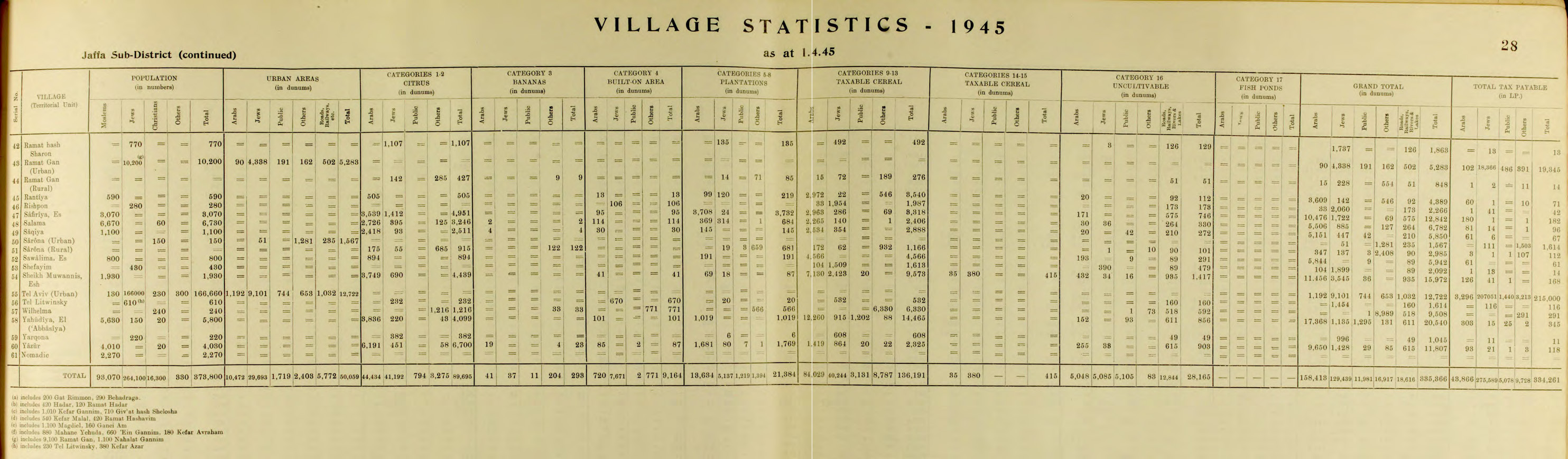
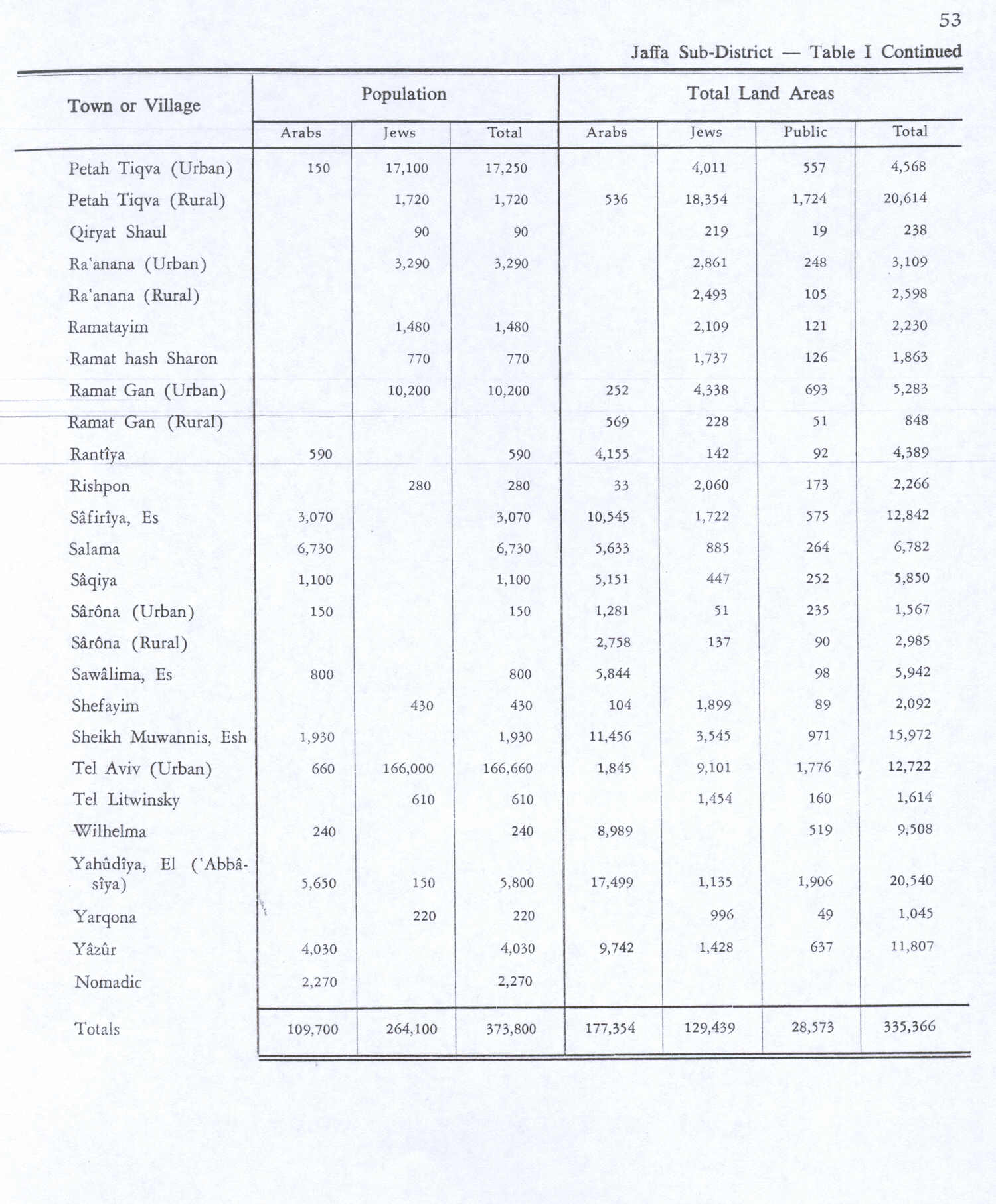
| • Total | 800[2][3] |
| Sebab pengosongan | Kekhawatiran akan ditangkap dalam pertikaian |
| Sebab sekunder | Pengaruh kejatuhan kota terdekat |
| Wilayah saat ini | Neve Sharett |
Al-Sawalima adalah sebuah desa Arab Palestina di Subdistrik Jaffa. Desa tersebut dikosongkan dalam Perang Saudara Mandat Palestina 1947–1948 pada 30 Maret 1948. Desa tersebut berjarak 11 km dari timur laut Jaffa, dan berjarak 2 km dari utara Sungai al-'Awja.
Referensi
Daftar pustaka
- Barron, J. B., ed. (1923). Palestine: Report and General Abstracts of the Census of 1922. Government of Palestine.
- Conder, C.R.; Kitchener, H. H. (1882). The Survey of Western Palestine: Memoirs of the Topography, Orography, Hydrography, and Archaeology. Vol. 2. London: Committee of the Palestine Exploration Fund.
- Department of Statistics (1945). Village Statistics, April, 1945. Government of Palestine.
- Hadawi, S. (1970). Village Statistics of 1945: A Classification of Land and Area ownership in Palestine. Palestine Liberation Organization Research Center. Diarsipkan dari asli tanggal 2018-12-08. Diakses tanggal 2009-08-18.
- Khalidi, W. (1992). All That Remains: The Palestinian Villages Occupied and Depopulated by Israel in 1948. Washington D.C.: Institute for Palestine Studies. ISBN 0-88728-224-5.
- Mills, E., ed. (1932). Census of Palestine 1931. Population of Villages, Towns and Administrative Areas. Jerusalem: Government of Palestine.
- Morris, B. (2004). The Birth of the Palestinian Refugee Problem Revisited. Cambridge University Press. ISBN 978-0-521-00967-6.
- Palmer, E. H. (1881). The Survey of Western Palestine: Arabic and English Name Lists Collected During the Survey by Lieutenants Conder and Kitchener, R. E. Transliterated and Explained by E.H. Palmer. Committee of the Palestine Exploration Fund.
Pranala luar
- Welcome To al-Sawalima
- al-Sawalima, Zochrot
- Survey of Western Palestine, Map 13: IAA, Wikimedia commons